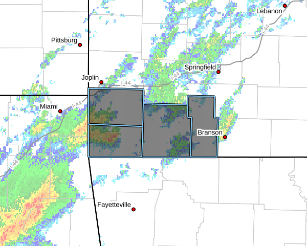
The National Weather Service says heavy rain overnight could leave some areas along and south of Highway 60 prone to flooding today.
More rain is on the way today, and it could be heavy at times.
Heavy rain from last night and early this morning will leave some areas vulnerable to flooding with additional rainfall possible at times through Friday. #mowx pic.twitter.com/i3sQaghhcB
— NWS Springfield (@NWSSpringfield) October 14, 2021
There’s a Flash Flood Watch through 7 tonight for Barry, Christian, Greene, Lawrence, McDonald, Newton, Stone and Taney counties.
Friday will be wet with a few showers and thunderstorms possible. Cooler weather is expected late in the week. Dry weather is expected for the upcoming weekend. #mowx #kswx pic.twitter.com/yMTJp7T4Zo
— NWS Springfield (@NWSSpringfield) October 14, 2021